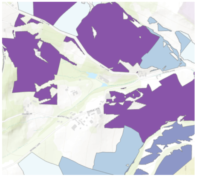
This dataset offers a mapped representation of land parcels ideally suited for ground-mounted solar installations. It not only identifies these suitable parcels but also estimates their maximum potential energy generation in kilowatts (kW) and potential annual generation (MWh).
This dataset offers a mapped representation of land parcels ideally suited for ground-mounted solar installations. It not only identifies these suitable parcels but also estimates the maximum potential energy generation in kilowatts (kW) and potential annual generation (MWh) based on the land parcel’s area, orientation, slope, and potential constraints such as excluding flood zones, proximity to transport links, etc.
This information proves essential in making informed decisions about harnessing solar energy, maximising the utilisation of available land resources, and achieving energy generation goals in an environmentally sustainable manner.
Specification
Product Format
Polygon (.shp, .geojson)
Delivery Method
Digital delivery
Geographic Coverage
National (GB)
Register to access the full article
Designed to aid Local Authorities in developing robust, evidence-based plans to enable Net Zero.
Guest preview of selected publicly available resources
Full library of 1,000+ articles
CPD accredited e-learning courses
Case studies
Discussion forum
Manage Consent
To provide the best experiences, we use technologies like cookies to store and/or access device information. Consenting to these technologies will allow us to process data such as browsing behaviour or unique IDs on this site. Not consenting or withdrawing consent, may adversely affect certain features and functions.
Functional
Always active
The technical storage or access is strictly necessary for the legitimate purpose of enabling the use of a specific service explicitly requested by the subscriber or user, or for the sole purpose of carrying out the transmission of a communication over an electronic communications network.
Preferences
The technical storage or access is necessary for the legitimate purpose of storing preferences that are not requested by the subscriber or user.
Statistics
The technical storage or access that is used exclusively for statistical purposes.The technical storage or access that is used exclusively for anonymous statistical purposes. Without a subpoena, voluntary compliance on the part of your Internet Service Provider, or additional records from a third party, information stored or retrieved for this purpose alone cannot usually be used to identify you.
Marketing
The technical storage or access is required to create user profiles to send advertising, or to track the user on a website or across several websites for similar marketing purposes.


 Guest preview of selected publicly available resources