The IRENES Land Use Tool is an online mapping facility that includes information on renewable electricity generation potentials and a wide variety of land use or environmental factors that are relevant to siting decisions.
Resource
The IRENES Land Use Tool is an online mapping facility that includes information on renewable electricity generation potentials and a wide variety of land use or environmental factors that are relevant to siting decisions.
Experience Level:
Foundation


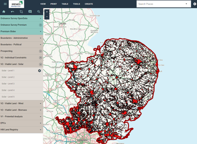
The IRENES Land Use Tool is an online mapping facility that has been created from analyses conducted in an Interreg Europe project with funding from the Greater South East Net Zero Hub, five county councils, and the UK Energy Research Centre. It includes information on renewable electricity generation potentials and a wide variety of land use or environmental factors that are relevant to siting decisions. Users can explore these factors at a parish level or define their own areas of interest and examine the generation potential.
At present, the tool coverage is the counties of Cambridgeshire, Essex, Hertfordshire, Norfolk, and Suffolk.
© Geoxphere 2026
Designed to aid Local Authorities in developing robust, evidence-based plans to enable Net Zero.
Already have an account? Login
 Guest preview of selected publicly available resourcesFull library of 1,000+ articlesCPD accredited e-learning coursesCase studiesDiscussion forum